THIS WEEK IN THE DAMAGE REPORT

This week in North Harris County, Texas, residents reported ongoing water issues for nearly a week before a major water main break disrupted the Rushcreek community. According to neighbors, signs of leakage were visible days before the rupture escalated, ultimately leading to flooding and infrastructure damage.
When early warning signs are missed or delayed in response, minor infrastructure failures can quickly become major disruptions.
DAMAGE OF THE WEEK
What Happened?
In the Rushcreek area of North Harris County, a water main break caused flooding and service disruption after residents had reportedly noticed issues with the line earlier in the week. Local reporting from ABC13 indicated that neighbors observed ongoing water-related concerns before the break was addressed.
What began as a suspected issue progressed into a significant rupture, impacting roads, property, and local water service.
Why It Happened
While investigations are ongoing, early reports suggest the line may have been experiencing stress or leakage before the full break occurred.
This points to a broader challenge across utilities nationwide:
• Aging underground infrastructure
• Limited real-time monitoring
• Incomplete subsurface visibility
• Delayed reporting or response workflows
Without accurate, accessible field data, small issues remain underground, until they surface dramatically.
The Real Impact
When a water main fails, the damage extends beyond the pipe itself:
• Water service interruptions
• Flooded roadways and property damage
• Emergency repair costs
• Increased strain on municipal resources
• Community frustration and safety concerns
Infrastructure breakdown doesn’t just create repair work.
It creates reputational risk.
Main Source: Water main break in Rushcreek, North Harris County — ABC13 (Published Feb. 2026)
SOCIAL MEDIA See It For Yourself
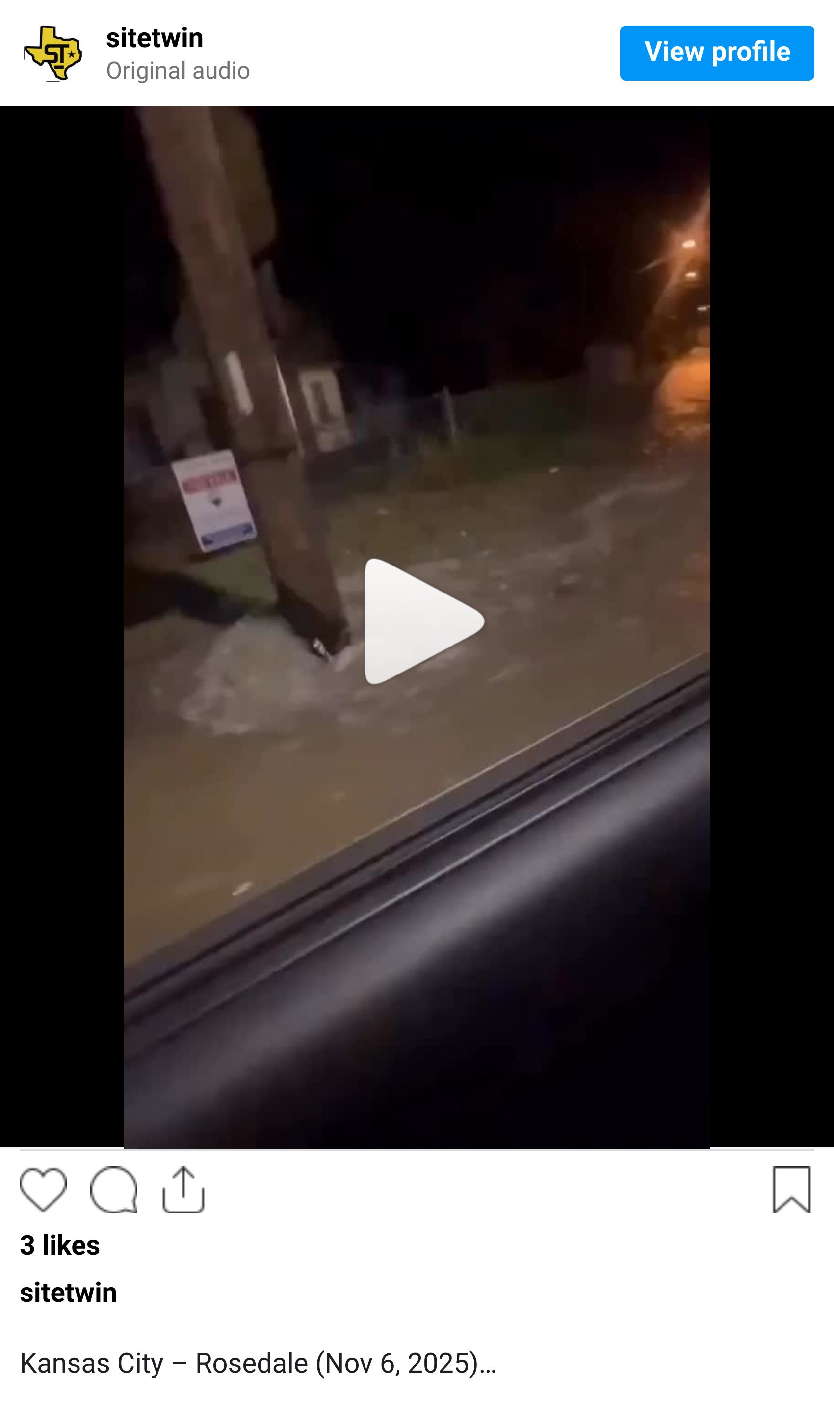

Different Cities. Same Pattern.
This week’s Texas water main break is not an isolated event, it’s part of a broader pattern we continue to see nationwide.
From neighborhood flooding in Kansas to tunnel disruptions in Boston, the underlying themes remain consistent:
Aging infrastructure under pressure
Limited visibility into subsurface conditions
The cascading impact of one failure point
Water infrastructure doesn’t fail quietly. When it breaks, it disrupts homes, traffic, businesses, and emergency resources, often within minutes.
The lesson isn’t just about response. It’s about prevention.
Accurate mapping. Coordinated excavation. Real-time field data. Clear communication between contractors and asset owners.
Every major break is a reminder: underground risk is invisible — until it isn’t.
DAMAGE CONTROL TIP
Catch small failures before they escalate.
Not every rupture can be prevented but many can be anticipated.
Proactive measures include:
• Centralized reporting systems for field observations
• Digitized maintenance logs
• Real-time mapping updates
• Cross-team visibility between crews and management
• Routine infrastructure condition audits
When field intelligence is siloed, early warning signs get missed.
When it’s centralized, teams can act before escalation.
UTILITY STRIKE SNAPSHOT
National infrastructure studies consistently show that aging water systems are one of the leading contributors to municipal service disruptions. Many water systems across the U.S. were installed decades ago and operate beyond their original design lifespan.
Without clear subsurface records and ongoing condition tracking, reactive repairs become the norm.
And reactive systems are expensive systems.

SiteTwin is your damage control tip!
Why This Matters
Water main breaks are often framed as isolated incidents.
They’re not.
They’re symptoms of broader data visibility challenges:
• Incomplete asset records
• Lack of centralized field documentation
• Delayed response coordination
• Limited predictive insight
Infrastructure risk compounds when information gaps exist.
Closing Insight
Utility mapping and locating reduces risk by improving visibility, not just at excavation sites, but across the full lifecycle of underground assets.
SiteTwin helps teams capture, centralize, and understand field data before small issues become large disruptions.
Learn more, see recent projects, or request support:
https://linktr.ee/sitetwin
Until next time,
The Damage Report by SiteTwin